
🌍 Records from the halls of power
Radcliffe Line: How a Border Drawn in About Five Weeks Changed South Asia
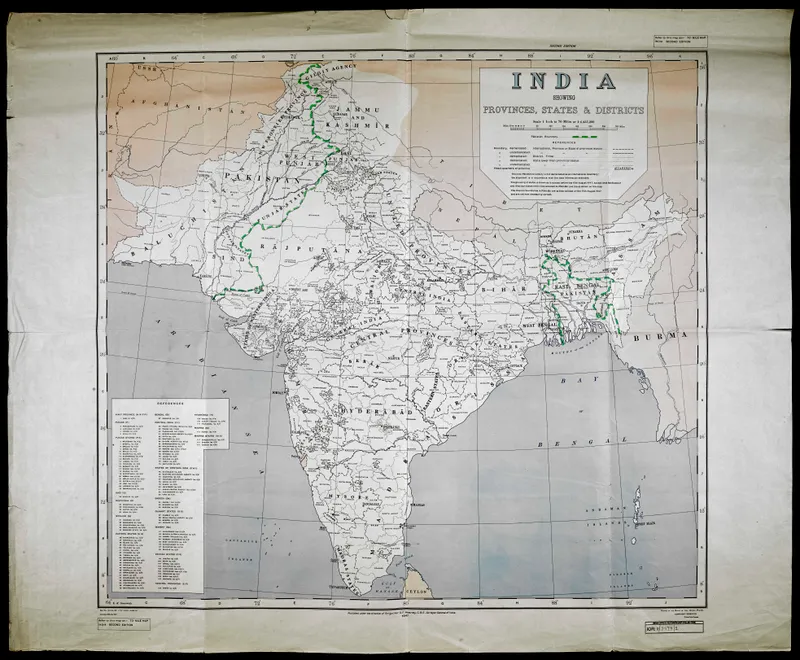
- What: The Radcliffe Line was the hurried 1947 border drawn to divide British India into India and Pakistan, with major and lasting human, political, and geographic consequences.
- Where: Punjab and Bengal, in South Asia.
- When: 1947, during Partition and the end of British rule in India.
In 1947, the Radcliffe Line drew the new border between India and Pakistan in about five weeks. It was one of the most consequential lines of the 20th century, and it was drawn in a rush.
How the Radcliffe Line Was Drawn
The event came at the end of British rule in South Asia. As partition moved forward, Britain appointed Sir Cyril Radcliffe, a British lawyer who had never been to India before, to chair two boundary commissions. His job was to divide Punjab in the northwest and Bengal in the east between the new states of India and Pakistan. On paper, the task sounded administrative. On the ground, it meant deciding where millions of people would wake up as citizens of a different country.
The problem was not just speed, though the speed was extraordinary. Districts were religiously mixed. Rail lines, canals, roads, farms, and market towns had grown together over decades. Families lived across the areas being divided. Any border would cut through functioning systems and human relationships. Radcliffe worked with outdated maps, census data, and intense political pressure, while violence was already spreading.
Partition Border Announcement in 1947
The award was finalized around the time of independence in August 1947 and publicly announced on 17 August, after India and Pakistan had already become independent. In Punjab especially, uncertainty fed panic. People did not always know which side their town would fall on. Then the line became real all at once. One village was in India, another in Pakistan. A rail route now crossed an international frontier. A canal headworks decision suddenly mattered to entire farming regions.
The immediate human cost was catastrophic. Partition triggered one of the largest mass migrations in history, with millions crossing the new borders. Communal massacres, abductions, and forced displacement followed. Historians differ on exact numbers, but the death toll is widely estimated in the hundreds of thousands, with some estimates reaching around a million or more.
Legacy of the India-Pakistan Border
The deeper consequence is that the border was never just a line on a map. It hardened political identities, reshaped military strategy, disrupted local economies, and left disputes that lasted far beyond 1947. The India-Pakistan relationship, including later wars and repeated border tensions, cannot be separated from the hurried geography of partition.
That is the concrete legacy of the Radcliffe Line: a boundary drafted in weeks still runs through Punjab and Bengal’s history, through family memory, through transport routes and water systems, and through one of the most heavily guarded borders in the world.
Did You Know?
Cyril Radcliffe had never visited India before he was asked to draw the border.