🌍 Records from the halls of power
Salar de Uyuni Helps Calibrate Satellites from the Ground
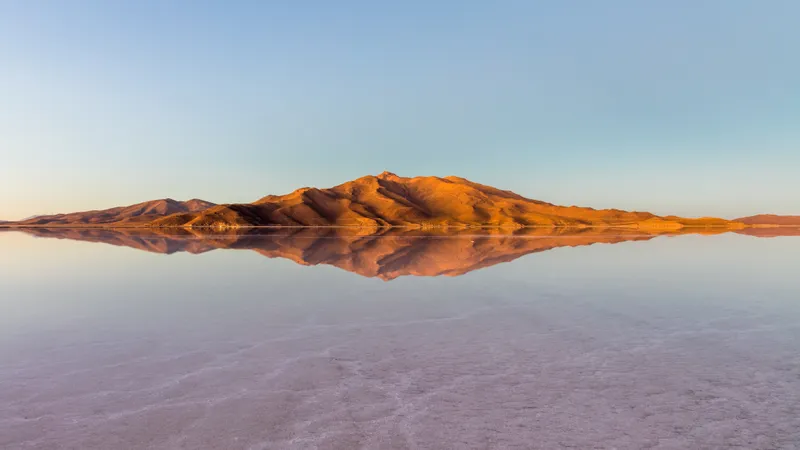
- What: Salar de Uyuni is used as a natural reference site for calibrating satellite instruments because its vast, bright, and unusually flat salt surface provides stable ground measurements.
- Where: Southwest Bolivia, on the Bolivian Altiplano.
- When:
In southwest Bolivia, Salar de Uyuni is not just a famous salt flat. It is also useful to space agencies because its surface is unusually broad, bright, and level, making it a valuable natural reference for checking satellite instruments.
Why Salar de Uyuni Matters
That matters because satellites do not measure Earth with perfect certainty. Their sensors have to be tested against places on the ground with known, stable characteristics. Salar de Uyuni, which covers more than 10,000 square kilometers on the Bolivian Altiplano, offers exactly that kind of target. In dry conditions, its salt crust is highly reflective and remarkably uniform over long distances. During parts of the wet season, a thin layer of water can turn sections of the flat into a near-mirror, which is useful for certain kinds of optical and elevation checks.
The concept is simple: if a satellite passes over a place whose brightness, flatness, or elevation is well characterized, scientists can compare the satellite’s reading with what they already know. If the numbers drift, the instrument may need correction. That is one reason researchers have used Salar de Uyuni in calibration work for altimeters and other remote-sensing systems. NASA has been associated with this kind of calibration activity, and the site has also been used in work involving other space and research institutions.
Satellite Calibration and Altimeters
The flat is especially well known in discussions of elevation calibration because it has very small height differences across large areas. It is not perfectly flat in an absolute sense, and conditions vary with season, moisture, and surface changes. But at the scale that matters for satellite testing, its consistency is rare enough to make it globally important.
Global Value of the Salt Flat
The larger context is easy to miss. A remote landscape in Bolivia helps improve measurements used far beyond Bolivia, from mapping Earth’s surface to checking how accurately instruments track land, water, and ice. Reliability in satellite data often depends on reference sites that are physically simple, stable, and measurable. Salar de Uyuni is one of those places.
So the significance of this salt flat is concrete: when engineers need a real-world benchmark for satellite sensors and altimeters, this high-altitude plain can help them verify that the data coming down from orbit is as accurate as possible.
Did You Know?
Salar de Uyuni is also the world’s largest salt flat.